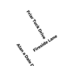
212 FRIAR TUCK DRIVE
Owner Information
DOBSON DEBORAH
LEVESQUE ELIZABETH
MARLBOROUGH, MA 01752


Property Details
212 FRIAR TUCK DRIVE is classified as a Single Family Residential (Rn).
The primary structure on this property was built in 1965. There are 1,054ft2 of built area within this property. There is 1,054ft2 of residential/living space within this property. This property is listed as having 6 rooms.
212 FRIAR TUCK DRIVE is valued at $88,400. The land is valued at $16,400 and the structures are valued at $72,000. There is an additional valuation of $2,600 on this property.
This property is in Zone R1. Confirm with local Zoning Board authorities to ensure there are no overlays or other easements on this property.
The most recent deed for 212 FRIAR TUCK DRIVE is recorded at the local registrar in Book 1899, Page 182. 212 FRIAR TUCK DRIVE was last sold on Thursday, April 19, 2001 for $4,000.
Assessment data from fiscal year 2020.
Flood Data
According to the FEMA National Flood Hazard Layer, this property does not appear to be in a flood zone. It may also be in an area not yet reviewed. Nonetheless, confirm this information prior to taking any action.
To view the flood hazards around this property, create a FEMA "Firmette" Map of the area around 212 FRIAR TUCK DRIVE.
Broadband Internet Providers
| Provider | Type | Bandwidth (mbps) | |
|---|---|---|---|
| VSAT Systems, LLC. | Satellite | 2 | 1 |
| Viasat Inc | Satellite | 35 | 3 |
| Verizon New England Inc. | DSL | 5 | 0 |
| GCI Communication Corp. | Satellite | 0 | 0 |
| HughesNet | Satellite | 25 | 3 |
Broadband service provider data from December 2020.
Adjacent Properties
- 224 FRIAR TUCK DRIVE
Single Family Residential owned by CALUORI ROBERT & JOAN - 0 FRIAR TUCK DRIVE
Accessory Land with Improvement owned by YESHIVA DVER YESHORIM - 0 ALAN A DALE DRIVE
(formerly Municipalities/Districts. Removed June 2009.) owned by TOWN OF BECKET - 0 ALAN A DALE DRIVE
Developable Residential Land owned by RODRIGUES FERNANDA J